
Category:Castle Donington

village in Leicestershire, England, UK  | |||||
| Upload media | |||||
| Instance of | |||||
|---|---|---|---|---|---|
| Location | North West Leicestershire, Leicestershire, East Midlands, England | ||||
| Population |
| ||||
| Different from | |||||
 | |||||
Cebuano: Castle Donington maoy lungsod sa Hiniusang Gingharian. Ang Castle Donington nahimutang sa distrito sa North West Leicestershire, kondado sa Leicestershire ug apil sa nasod sa Inglatera, sa habagatang bahin sa nasod, ka molupyo (→Castle Donington (lungsod))
English: Castle Donington is a small market town and civil parish in Leicestershire, England. It is situated on the edge of the National Forest close to East Midlands Airport. (→Castle Donington)
Esperanto: Castle Donington estas loĝloko kun proksimume 7000 loĝantoj en la nordoriento de la provinco Leicestershire de Anglio. En ĝia areo troviĝas la flughaveno East Midlands Airport, 2 kilometrojn sude de la loĝloka centro. La regione centra urbo, Leicester, situas 40 kilometrojn sudokcidente. (→Castle Donington)
Français : Castle Donington est un village d'une population avoisinant personnes située au nord-ouest du Leicestershire, à proximité de Derby et de Nottingham. Il s'agit du village le plus proche de l'aéroport d'East Midlands et de l'entreprise postale DHL qui sont les principaux employeurs. (→Castle Donington)
Magyar: Castle Donington egy kb. 7000 lakosú falu Leicestershire északnyugati részén az Egyesült Királyságban, a Trent jobb partján. Az East Midlands repülőtérhez legközelebb eső település. (→Castle Donington)
Nederlands: Castle Donington is een plaats en civil parish in het bestuurlijke gebied North West Leicestershire, in het Engelse graafschap Leicestershire met 7000 inwoners. (→Castle Donington)
Polski: Castle Donington – wieś w Anglii, w hrabstwie Leicestershire, w dystrykcie North West Leicestershire. Leży 27 km na północny zachód od miasta Leicester i 170 km na północny zachód od Londynu. Miejscowość liczy 7000 mieszkańców. (→Castle Donington)
Subcategories
This category has the following 11 subcategories, out of 11 total.
Media in category "Castle Donington"
The following 200 files are in this category, out of 454 total.
(previous page) (next page)-
 Hall Farmhouse, High Street, Castle Donington - geograph.org.uk - 6188137.jpg 1,280 × 1,280; 452 KB
-
 Handless clock - geograph.org.uk - 3465720.jpg 640 × 447; 464 KB
-

-
 Hemington trackway - geograph.org.uk - 5083368.jpg 480 × 640; 72 KB
-
 Hemington trackway - geograph.org.uk - 5083372.jpg 480 × 640; 71 KB
-
 High Street entering Castle Donington - geograph.org.uk - 6017743.jpg 1,024 × 768; 120 KB
-
 High Street, Castle Donington - geograph.org.uk - 3407130.jpg 800 × 507; 65 KB
-
 High Street, Castle Donington - geograph.org.uk - 5047674.jpg 640 × 480; 70 KB
-
 Hill Top Farm - geograph.org.uk - 5046844.jpg 640 × 480; 57 KB
-
 Hill Top Farm south of Castle Donington - geograph.org.uk - 6017720.jpg 1,024 × 768; 93 KB
-
 Hill Top south of Castle Donington - geograph.org.uk - 6017724.jpg 1,024 × 768; 171 KB
-
 Hillside in Castle Donington - geograph.org.uk - 5686603.jpg 1,024 × 768; 102 KB
-
 Hillside, Castle Donington - geograph.org.uk - 6533513.jpg 1,600 × 1,200; 472 KB
-
 Historic walls, High Street, Castle Donington - geograph.org.uk - 6187914.jpg 1,280 × 893; 363 KB
-
 Horse trough at Castle Donington - geograph.org.uk - 2253294.jpg 1,024 × 768; 256 KB
-
 Horse trough, High Street Castle Donington - geograph.org.uk - 6187912.jpg 1,280 × 903; 465 KB
-
 House on the Barroon - geograph.org.uk - 5431058.jpg 2,000 × 1,333; 2.25 MB
-
 House on the High Street, Castle Donington - geograph.org.uk - 6598023.jpg 1,600 × 1,065; 533 KB
-
 Houses on Hill Top, Castle Donington - geograph.org.uk - 5046848.jpg 640 × 480; 66 KB
-

-

-

-

-

-
 Infield area at Donington Park race circuit - geograph.org.uk - 7997282.jpg 4,000 × 3,000; 4.07 MB
-
 Infield area at Donington Park race circuit - geograph.org.uk - 7997283.jpg 4,000 × 3,000; 4.45 MB
-
 Inscribed stone - geograph.org.uk - 1437232.jpg 640 × 479; 95 KB
-

-
 Island in the River Trent - geograph.org.uk - 4795506.jpg 1,280 × 960; 259 KB
-
 Jet2 Boeing 737-330 - geograph.org.uk - 3676576.jpg 1,600 × 981; 345 KB
-
 Jetpark 2 at East Midlands Airport - geograph.org.uk - 6187457.jpg 1,280 × 960; 269 KB
-
 Looking up Park Lane - geograph.org.uk - 6039540.jpg 2,000 × 1,333; 2.42 MB
-
 Market Street - geograph.org.uk - 2253706.jpg 1,024 × 750; 235 KB
-
 Melbourne hairpin, Donington circuit, 1970 - geograph.org.uk - 2019706.jpg 1,766 × 1,193; 860 KB
-
 Milepost at Castle Donington - geograph.org.uk - 2253319.jpg 768 × 1,024; 329 KB
-
 Minor road joins the A453 - geograph.org.uk - 6597123.jpg 1,600 × 1,101; 683 KB
-
 Minor road towards Castle Donington - geograph.org.uk - 5046842.jpg 640 × 480; 52 KB
-
 MOAT street name sign, Castle Donington - geograph.org.uk - 6189675.jpg 1,280 × 960; 476 KB
-
 Moira Arms, Castle Donington.jpg 706 × 352; 79 KB
-
 Moll's Row - geograph.org.uk - 3870310.jpg 1,200 × 900; 168 KB
-
 Mount Pleasant - geograph.org.uk - 1437318.jpg 640 × 479; 68 KB
-
 Mown woodland at Donington Park - geograph.org.uk - 7761062.jpg 4,080 × 3,072; 5.87 MB
-
 New house building on Craner Road - geograph.org.uk - 6563700.jpg 1,280 × 960; 325 KB
-
 New houses under construction - geograph.org.uk - 6563722.jpg 1,280 × 960; 362 KB
-
 New road and houses - geograph.org.uk - 7380899.jpg 1,280 × 960; 311 KB
-
 New road construction - geograph.org.uk - 6187481.jpg 1,280 × 851; 282 KB
-
 North Leicestershire countryside - geograph.org.uk - 6187438.jpg 1,280 × 960; 387 KB
-
 Norton motor cycles - geograph.org.uk - 6322852.jpg 2,000 × 1,330; 1.78 MB
-
 Outbuildings at 15 High Street, Castle Donington - geograph.org.uk - 6188108.jpg 1,280 × 960; 333 KB
-
 Outbuildings at 15 High Street, Castle Donington - geograph.org.uk - 6188117.jpg 1,280 × 903; 357 KB
-
.jpg/120px-Outhouse_adjacent_to_4_Apiary_Gate_(geograph_7530306).jpg) Outhouse adjacent to 4 Apiary Gate (geograph 7530306).jpg 1,024 × 768; 165 KB
Outhouse adjacent to 4 Apiary Gate (geograph 7530306).jpg 1,024 × 768; 165 KB
-
 Park farmhouse guest house - geograph.org.uk - 810882.jpg 640 × 480; 64 KB
-
 Park Farmhouse Hotel - geograph.org.uk - 4904120.jpg 3,264 × 2,448; 4.77 MB
-

-
 Park Lane Nurseries - geograph.org.uk - 4404091.jpg 1,280 × 853; 381 KB
-

-
 Parking Area at Donington Racing Circuit - geograph.org.uk - 4365744.jpg 4,000 × 3,000; 2.15 MB
-
 Passage off Borough Street, Castle Donington - geograph.org.uk - 7530323.jpg 1,024 × 768; 184 KB
-
 Passing Castle Donnington - geograph.org.uk - 1123592.jpg 640 × 416; 147 KB
-

-

-
 Path through EMA - geograph.org.uk - 1343959.jpg 640 × 480; 117 KB
-
 Perimeter fence at East Midlands Airport - geograph.org.uk - 3676529.jpg 1,600 × 1,200; 743 KB
-
 Peripheral road at Donington Park - geograph.org.uk - 7997280.jpg 4,000 × 3,000; 5.25 MB
-

-
 Pinfold Gardens - geograph.org.uk - 3870326.jpg 1,200 × 900; 285 KB
-
 Pinfold Gardens, Castle Donington - geograph.org.uk - 6189718.jpg 1,280 × 902; 346 KB
-
 Pinford Memorial Gardens, Bondgate, Castle Donington - geograph.org.uk - 6598008.jpg 1,600 × 1,065; 793 KB
-
 Pit lane Donington race circuit - geograph.org.uk - 4626629.jpg 1,024 × 768; 152 KB
-
 Pitlane at Donington Park circuit - geograph.org.uk - 7581173.jpg 4,080 × 3,072; 3.23 MB
-
 Plantation on Daleacre Hill - geograph.org.uk - 715690.jpg 640 × 469; 72 KB
-
 Plaque, 65 High Street, Castle Donington - geograph.org.uk - 6187934.jpg 960 × 1,280; 364 KB
-
 Pond by the car park - geograph.org.uk - 6563865.jpg 1,280 × 960; 776 KB
-

-
 Pool near Cavendish Bridge - geograph.org.uk - 7966043.jpg 1,600 × 1,150; 479 KB
-
 Post here, bin there - geograph.org.uk - 1437345.jpg 460 × 640; 112 KB
-
 Postbox, Castle Donington P.O. - geograph.org.uk - 1437274.jpg 479 × 640; 69 KB
-
 Pretty in Pink^ - geograph.org.uk - 3870339.jpg 1,200 × 900; 123 KB
-
 Primary school, Castle Donington - geograph.org.uk - 5083406.jpg 480 × 640; 58 KB
-

-
 Public footpath through the Jetparks - geograph.org.uk - 6187455.jpg 1,280 × 960; 412 KB
-
 Pylon and scrub - geograph.org.uk - 3465659.jpg 640 × 427; 302 KB
-
 Race control building and garages at Donington Park - geograph.org.uk - 7860118.jpg 4,080 × 3,072; 2.49 MB
-
 Racing at Donington Park - geograph.org.uk - 7834251.jpg 800 × 533; 99 KB
-
 Railway heading west - geograph.org.uk - 5047756.jpg 640 × 480; 62 KB
-

-
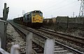
 Railway lines at Castle Donington - geograph.org.uk - 7966048.jpg 1,600 × 1,262; 634 KB
-
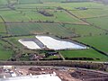 Reservoirs at Brooklet Farm - geograph.org.uk - 4903604.jpg 3,264 × 2,448; 3.87 MB
-

-

-

-
 River Trent - geograph.org.uk - 4488913.jpg 640 × 480; 44 KB
-
 River Trent - geograph.org.uk - 4511216.jpg 640 × 480; 45 KB
-
 River Trent at Shardlow - geograph.org.uk - 5280245.jpg 640 × 480; 66 KB
-
 River Trent looking South - geograph.org.uk - 7811237.jpg 3,072 × 4,096; 3.16 MB
-
 River Trent near Castle Donington - geograph.org.uk - 7518603.jpg 4,000 × 1,569; 1.14 MB
-
 River Trent near Shardlow - geograph.org.uk - 1156096.jpg 640 × 480; 151 KB
-
 River Trent near Shardlow - geograph.org.uk - 1156097.jpg 640 × 480; 189 KB
-
 River Trent near Shardlow - geograph.org.uk - 3069183.jpg 640 × 480; 70 KB
-

-
 Riverside footpath - geograph.org.uk - 6667266.jpg 4,032 × 3,024; 6.42 MB
-

-

-

-

-
 Roundabout - geograph.org.uk - 6066240.jpg 1,024 × 768; 132 KB
-
 Roundabout - geograph.org.uk - 6066244.jpg 1,024 × 768; 142 KB
-
 Roundabout at Hill Top, Castle Donington - geograph.org.uk - 6598027.jpg 1,600 × 1,097; 366 KB
-
 Roundabout on Broad Rushes - geograph.org.uk - 5047754.jpg 640 × 480; 44 KB
-
 Roundabout on the A453 - geograph.org.uk - 5046824.jpg 640 × 480; 47 KB
-
 Runway - East Midlands Airport - geograph.org.uk - 4597469.jpg 3,456 × 4,608; 3.54 MB
-
 Runway at East Midlands Airport - geograph.org.uk - 4597301.jpg 4,151 × 2,186; 2.27 MB
-
 Ryanair Boeing 737-8AS - geograph.org.uk - 3676317.jpg 1,600 × 1,051; 264 KB
-

-
 Sailors' and Soldiers' Club - geograph.org.uk - 1437216.jpg 640 × 479; 78 KB
-

-
 Shardlow Industrial Estate - geograph.org.uk - 5659440.jpg 1,280 × 848; 321 KB
-
 Shardlow, The Old Salt Warehouse - geograph.org.uk - 2231221.jpg 681 × 1,024; 124 KB
-
 Shields Crescent - geograph.org.uk - 6039538.jpg 2,000 × 1,333; 2.09 MB
-
 Signage - A50 westbound - geograph.org.uk - 6779319.jpg 1,024 × 768; 135 KB
-
 Sky Ladder - geograph.org.uk - 3841726.jpg 900 × 1,200; 467 KB
-
 Sky Ladder on the Airport Trail - geograph.org.uk - 6187436.jpg 851 × 1,280; 497 KB
-
 Sky Ladder on the Airport Trail – detail - geograph.org.uk - 6187437.jpg 1,280 × 989; 637 KB
-
 Small oak tree - geograph.org.uk - 6667271.jpg 4,032 × 3,024; 4.12 MB
-
 Snowy footpath and pylon by the River Trent - geograph.org.uk - 4795445.jpg 1,280 × 960; 354 KB
-
 Solar energy - for the sake of it. - geograph.org.uk - 684579.jpg 427 × 640; 236 KB
-
 South Derbyshire Countryside - geograph.org.uk - 1742459.jpg 3,072 × 2,304; 3.02 MB
-
 Springhill House, High Street, Castle Donington - geograph.org.uk - 6188104.jpg 1,280 × 981; 311 KB
-
 St Anne's Lane - geograph.org.uk - 1437280.jpg 479 × 640; 70 KB
-
 St Edward's School - geograph.org.uk - 1437293.jpg 640 × 479; 84 KB
-
 St Edward's School - geograph.org.uk - 1437300.jpg 479 × 640; 98 KB
-
 St Edward's School - geograph.org.uk - 1437305.jpg 480 × 640; 120 KB
-
 St Edwards C of E Primary School, Castle Donington - geograph.org.uk - 6533510.jpg 1,600 × 1,200; 457 KB
-
 Station Road at Castle Donington - geograph.org.uk - 7966060.jpg 1,600 × 1,451; 554 KB
-
 Station Road, Castle Donington - geograph.org.uk - 6189722.jpg 1,280 × 873; 315 KB
-
 Steps and stile on a field path to Diseworth - geograph.org.uk - 3841740.jpg 1,200 × 900; 424 KB
-
 Still frosty - geograph.org.uk - 6039511.jpg 2,000 × 1,333; 2.98 MB
-
 Storehouse at 4 Apiary Gate, Castle Donington - geograph.org.uk - 6189698.jpg 950 × 1,280; 316 KB
-
 Swan Rivers Pond - geograph.org.uk - 6187441.jpg 1,280 × 960; 338 KB
-
 Swan Rivers Pond reflecting wind turbine - geograph.org.uk - 3841733.jpg 1,200 × 900; 153 KB
-
 Table tombs in the churchyard, Castle Donington - geograph.org.uk - 7529737.jpg 1,024 × 768; 307 KB
-
 Tanyard Close - geograph.org.uk - 6066079.jpg 1,024 × 768; 200 KB
-
 Temporary footbridge for the Download Festival - geograph.org.uk - 4516723.jpg 1,200 × 900; 141 KB
-

-
 The Apiary Cafe Bar - geograph.org.uk - 4527047.jpg 1,200 × 900; 150 KB
-
 The Barroon Cemetery - geograph.org.uk - 5431064.jpg 2,000 × 1,333; 2.72 MB
-
 The car park at Donington Hall - geograph.org.uk - 6322798.jpg 2,000 × 1,330; 2.65 MB
-
 The Castle Inn, High Street, Castle Donington - geograph.org.uk - 6598018.jpg 1,600 × 1,065; 469 KB
-
 The Cedars, High Street, Castle Donington - geograph.org.uk - 6188110.jpg 1,280 × 875; 503 KB
-
 The Cross Keys on Bondate, Cattle Donington - geograph.org.uk - 6598013.jpg 1,600 × 1,065; 590 KB
-
 The edge of Castle Donington - geograph.org.uk - 6039526.jpg 2,000 × 1,333; 3.47 MB
-
 The flags are out - geograph.org.uk - 5531931.jpg 800 × 600; 83 KB
-
 The flags are out - geograph.org.uk - 5533203.jpg 800 × 600; 101 KB
-

-
 The former Donington Lane facing north - geograph.org.uk - 4472202.jpg 1,200 × 900; 201 KB
-
 The former Donington Lane facing south - geograph.org.uk - 4472206.jpg 1,200 × 900; 267 KB
-
 The former game store - geograph.org.uk - 6322872.jpg 2,000 × 1,330; 1.7 MB
-
 The Game Store - geograph.org.uk - 6322816.jpg 2,000 × 1,330; 2.1 MB
-
 The garden steps - geograph.org.uk - 6322802.jpg 2,000 × 1,330; 2.97 MB
-
 The German POW Graves - geograph.org.uk - 5431075.jpg 1,333 × 2,000; 2.97 MB
-
 The Grave Stone Inscription - geograph.org.uk - 5431082.jpg 2,000 × 1,333; 3.99 MB
-
 The ha ha - geograph.org.uk - 6322836.jpg 2,000 × 1,330; 2.24 MB
-
 The Hollow - geograph.org.uk - 1437263.jpg 640 × 479; 68 KB
-
 The Hump - geograph.org.uk - 6563816.jpg 1,280 × 960; 486 KB
-

-
 The Key House - geograph.org.uk - 2253544.jpg 1,024 × 768; 226 KB
-
 The Key House, High Street, Castle Donington - geograph.org.uk - 6188126.jpg 1,280 × 1,280; 394 KB
-
 The Key House, High Street, Castle Donington - geograph.org.uk - 6188130.jpg 960 × 1,280; 318 KB
-
 The Key House, High Street, Castle Donington - geograph.org.uk - 6188132.jpg 1,280 × 1,280; 414 KB
-

-
 The Norton Building - geograph.org.uk - 6322856.jpg 2,000 × 1,330; 1.95 MB
-
 The other edge of Castle Donington - geograph.org.uk - 6039535.jpg 2,000 × 1,333; 2.19 MB
-
 The River Trent at Shardlow - geograph.org.uk - 7198754.jpg 1,600 × 1,199; 405 KB
-
 The Sailors' and Soldiers' Club turned orange - geograph.org.uk - 4527068.jpg 1,200 × 900; 133 KB
-
 The Spittal - geograph.org.uk - 3465712.jpg 640 × 427; 486 KB
-
 The Stone House - geograph.org.uk - 1437338.jpg 640 × 516; 88 KB
-
 The Tarpey Gallery - geograph.org.uk - 5533212.jpg 800 × 600; 110 KB
-
 The view from the hall - geograph.org.uk - 6322820.jpg 2,000 × 1,330; 1.68 MB
-
 Total petrol station at Donington Park - geograph.org.uk - 7581182.jpg 4,080 × 3,072; 3.44 MB
-
 Towards Dalby's Covert - geograph.org.uk - 4843362.jpg 480 × 640; 64 KB
-
 Track by the Trent - geograph.org.uk - 1156091.jpg 640 × 480; 171 KB
-
 Track by the Trent - geograph.org.uk - 1156094.jpg 640 × 480; 185 KB
-
 Track near Hemington - geograph.org.uk - 6066237.jpg 768 × 1,024; 180 KB
-
 Tree planting - geograph.org.uk - 6563732.jpg 1,280 × 960; 513 KB
-
 Tree-lined avenue at Donington Hall - geograph.org.uk - 5533200.jpg 800 × 600; 209 KB
-
 Trees in the Trent - geograph.org.uk - 1156095.jpg 640 × 480; 174 KB
-
 Trees on the Derbyshire bank of the Trent - geograph.org.uk - 7407082.jpg 1,280 × 960; 418 KB
-
 Trent Lane, Castle Donington - geograph.org.uk - 5047728.jpg 640 × 480; 66 KB
-
 Trent Lane, Castle Donington - geograph.org.uk - 5047776.jpg 640 × 480; 51 KB
-
 Trent palaeochannel - geograph.org.uk - 4795465.jpg 1,280 × 960; 618 KB
-
 Trig Pillar - geograph.org.uk - 3907198.jpg 1,200 × 900; 217 KB
-
 Units at Donington Park - geograph.org.uk - 8141194.jpg 4,080 × 3,072; 4 MB
-
 Upright Willow in Leaf - geograph.org.uk - 842615.jpg 640 × 427; 226 KB
-
 Victoria Street, Castle Donington - geograph.org.uk - 3465657.jpg 640 × 427; 64 KB
-
 Victoria Street, Castle Donington - geograph.org.uk - 6650234.jpg 640 × 427; 64 KB
-
 Victory celebratory drive - Donington - geograph.org.uk - 2220351.jpg 1,600 × 1,067; 336 KB
-
 View towards Castle Donington - geograph.org.uk - 559011.jpg 640 × 478; 102 KB
-
 War memorial, High Street, Castle Donington - geograph.org.uk - 6188138.jpg 960 × 1,280; 526 KB
-

-
 Willow and Reflected Clouds - geograph.org.uk - 833947.jpg 640 × 427; 243 KB


.jpg)


